We provide advanced and reliable positioning systems and surveying solutions for the surveying, engineering, and related industries in the Americas. Through our exceptional, cost-effective product portfolio, professional technical support, and efficient localized services, we empower clients to enhance operational efficiency, data accuracy, and project success rates.
Our Mission: Dedicated to becoming a leader in the geospatial information industry in the Americas, we integrate the most competitive precision surveying technologies and solutions globally to build a future work environment that is high-precision, high-efficiency, and more cost-effective for our clients in the Americas.
Our Background: Despite being recently established, Alpha Positioning Systems Inc. was founded and is managed by professionals with extensive experience in the positioning and surveying solutions market, originating from major companies in the sector.
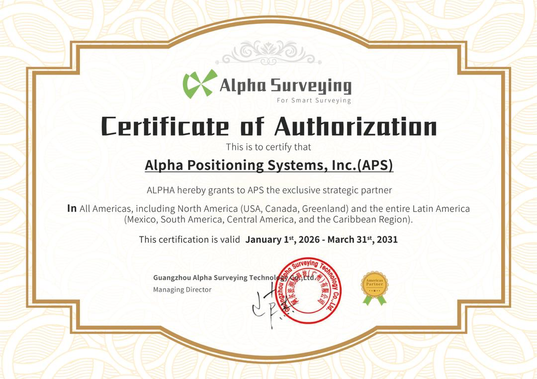
Strategic Partnership: We are the exclusive commercial partner of Alpha Surveying for all Americas, including North America (USA and Canada) and the entire Latin America (Mexico, South America, Central America, and the Caribbean Region).
Alpha Surveying is a high-tech enterprise specializing in surveying robots, unmanned surface vehicles and positioning technology. Established in 2020, it is the only manufacturer of surveying and mapping equipment with a complete production line that has emerged globally in the past decade. The company's headquarters is located in Guangzhou Science City, with R&D and production facilities in Guangzhou and Beijing.
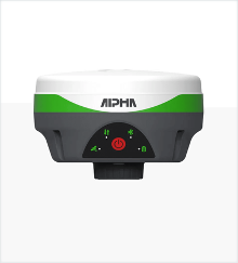
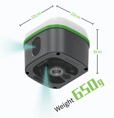
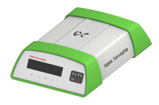
Ultra RTK
Ultra-compact GNSS RTK receiver with next-generation positioning engine. Only 9.8 cm in diameter and weighing 380 grams, it ushers professional RTK into the compact era.
Long-range RTK
Professional long-range RTK receiver with high-precision inertial system and ultra-long-range radio transceiver. Works longer, faster with higher accuracy.
Long-range RTK with 4G
Advanced RTK receiver with integrated 4G connectivity and Dimap Pro software support. Excels in complex measurement scenarios with 5W fully compatible data transmission radio.
Optic-electric RTK
Hybrid optical-electronic RTK system with laser measurement and AR camera capabilities for advanced field operations.
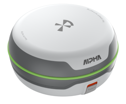
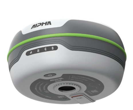
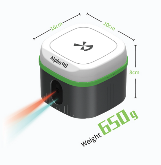
Visual Positioning RTK
Advanced visual positioning system with AR stake-out capabilities for precise field operations and real-time visualization.
RTK GNSS Receiver (Coming Soon)
Additional GNSS RTK receiver from the Alpha Surveying line, designed to complement high-precision positioning solutions.
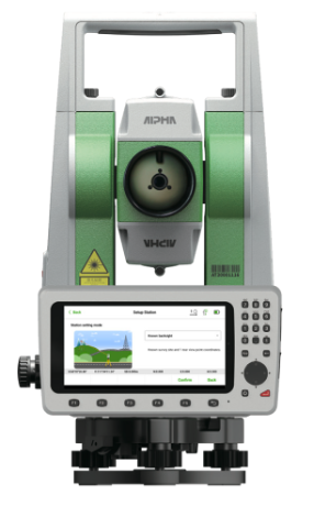
Standard 2" Total Station
Precision total station with 2" accuracy for professional surveying applications in various environments.
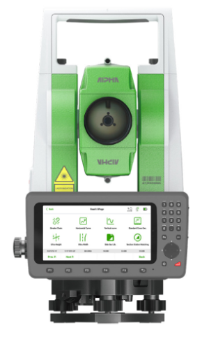
Standard 1" Total Station
High-precision 1" total station for demanding surveying and engineering projects requiring superior accuracy.
Android 2" Total Station
Android-based total station with 2" accuracy and integrated 5.5" transflective touch screen display for field operations.
Android 1" Total Station
High-precision Android total station with 1" accuracy for professional field work with advanced software capabilities.
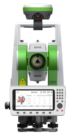
Super Station
Combined RTK and total station system for versatile surveying capabilities in any environment with dual positioning modes.
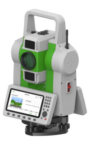
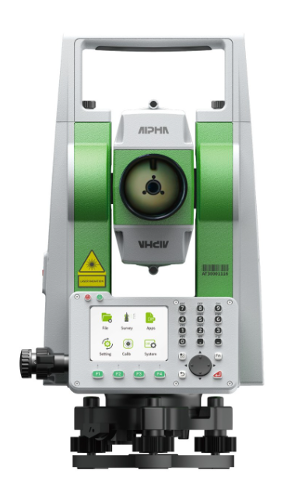
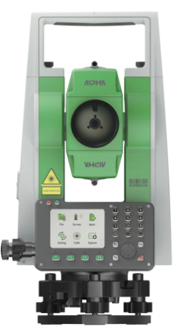
Robotic Total Station
Advanced robotic total station with automatic target tracking and remote control capabilities for one-person surveying operations.
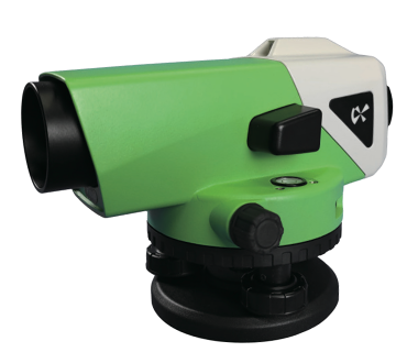
Auto Level
Automatic leveling instrument for precise elevation measurements and structural monitoring applications.
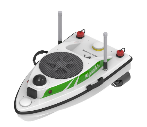
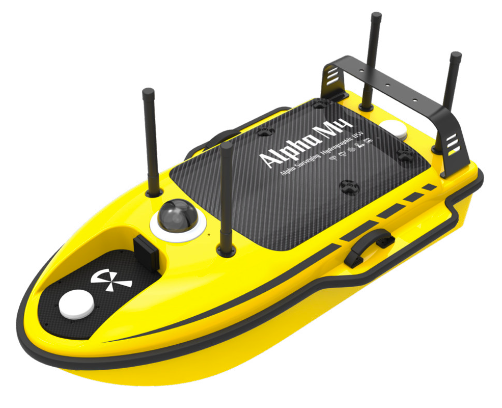
Swift USV
Compact unmanned surface vehicle for rapid hydrographic and bathymetric surveys with intelligent autonomous navigation.
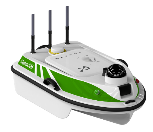
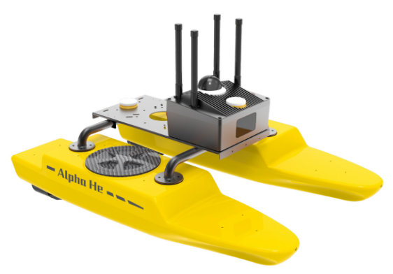
Surveying USV
Professional surveying USV for comprehensive hydrographic and bathymetric operations with extended working time.
Emergency Detection USV
Specialized USV for emergency response and rapid environmental monitoring in critical situations.
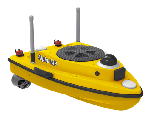
Hydrographic USV
Advanced hydrographic USV for comprehensive bathymetric survey operations with high payload capacity.
Catamaran USV
Smart catamaran USV with superior stability for hydrographic surveys in challenging waters and coastal areas.
Portable Echo Sounder
Professional portable echo sounder with Wi-Fi connectivity for cable-free bathymetric surveys in any water body.
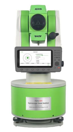
Gyro Total Station
Total station with integrated gyroscope for precise orientation and measurement in any direction.
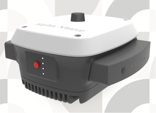
Reference Station
CORS-compatible reference station for network RTK and continuous monitoring operations with remote access.
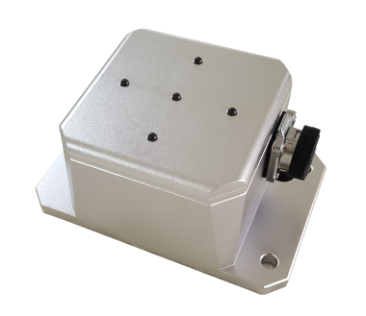
Tilt Sensor
Real-time tilt sensor for structural monitoring and deformation measurement in critical infrastructure.
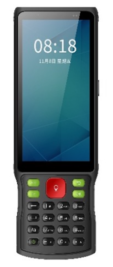
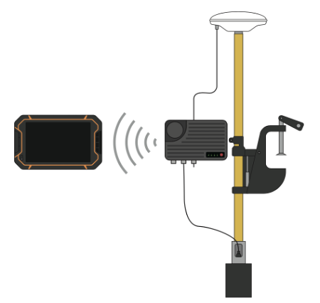
RTK Controller
Even more powerful controller! Greater battery autonomy, more sensors, better ergonomics for professional RTK operations.
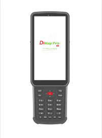
RTK Controller
Your RTK operation center. An intuitive controller with advanced configuration, intelligent features, and comfortable operation, designed to meet the needs of the most demanding surveyors.
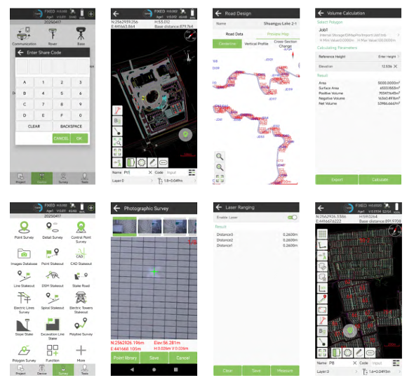
Professional Surveying Software
Professional field surveying platform based on Android for maximum productivity and efficiency in all surveying scenarios.
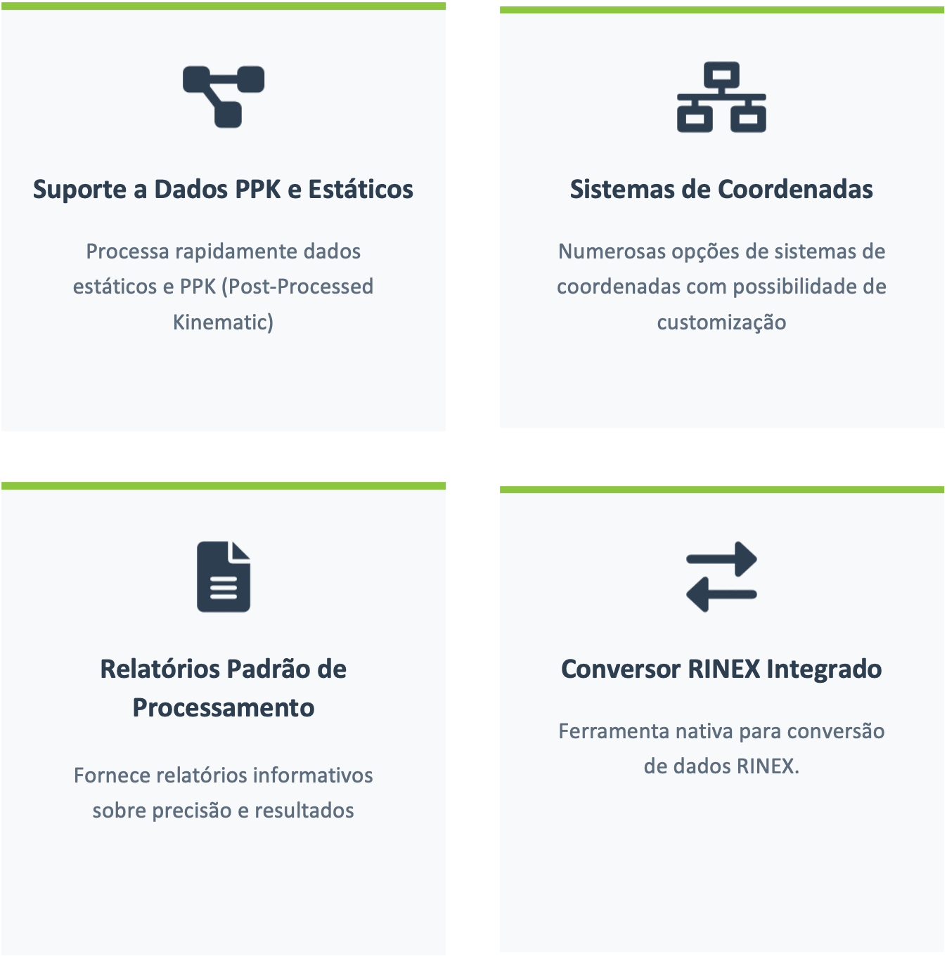
Advanced Geomatics Office
Comprehensive post-processing software suite for analyzing and transforming geospatial data with precision.
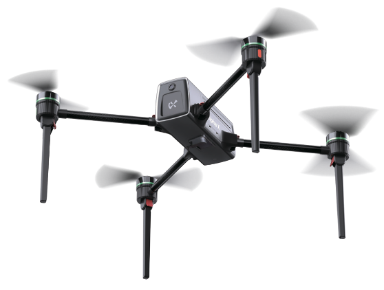
UAV System
Highly customizable unmanned aerial vehicle system for remote sensing and high-precision aerial photogrammetry applications.
No accessories available at this time. Check back soon for new products.
Alpha Positioning Systems Inc. has been established as the exclusive commercial partner of Alpha Surveying for all Americas, including North America (USA and Canada) and the entire Latin America (Mexico, South America, Central America, and the Caribbean Region).
Partnership Valid: January 1, 2026 - March 31, 2031
Alpha Positioning Systems Inc.
Canada
Monday - Friday
8:00 AM - 6:00 PM EST